 ar
ar bg
bg hr
hr cs
cs da
da nl
nl fi
fi fr
fr de
de el
el hi
hi it
it ko
ko no
no pl
pl pt
pt ro
ro ru
ru es
es sv
sv tl
tl iw
iw id
id lv
lv lt
lt sr
sr sk
sk sl
sl uk
uk vi
vi et
et hu
hu th
th tr
tr fa
fa ms
ms hy
hy ka
ka ur
ur bn
bn mn
mn ta
ta kk
kk uz
uz ku
ku
gauge water level
Kingmach gauge water level should be selected from the engineering question outward. If the question is pile foundation settlement or tunnel bottom uplift, an embedded single-point gauge such as JMDL-47XXAT may fit the job. If the question is bridge deflection or building settlement across several points, hydrostatic instruments such as JMDL-62XXADT or JMQJ-62XXADT can compare vertical change against a reference. If the question is large settlement during soft foundation treatment or reclamation filling, JMYC-62XXAD provides wider travel from 500 mm to 4000 mm. If the question involves layered soil settlement and groundwater level, JMCJ-1003/1005 gives a borehole-based manual method. A good specification therefore starts with movement scale, reading frequency, access, groundwater condition, reference stability, and report needs. During procurement review, engineers should check range, resolution, accuracy, output signal, installation method, and maintenance access together rather than selecting from model names alone. The acceptance record should keep model, range, reference relationship, baseline, installation detail, and channel name together for later review. The acceptance record should keep model, range, reference relationship, baseline, installation detail, and channel name together for later review. The acceptance record should keep model, range, reference relationship, baseline, installation detail, and channel name together for later review. The acceptance record should keep model, range, reference relationship, baseline, installation detail, and channel name together for later review.
Application of gauge water level
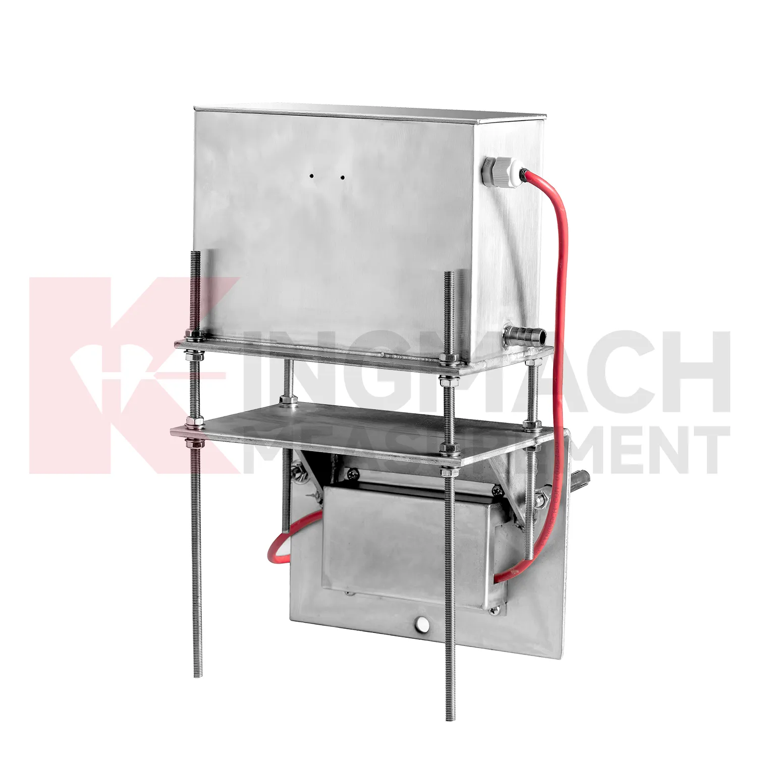
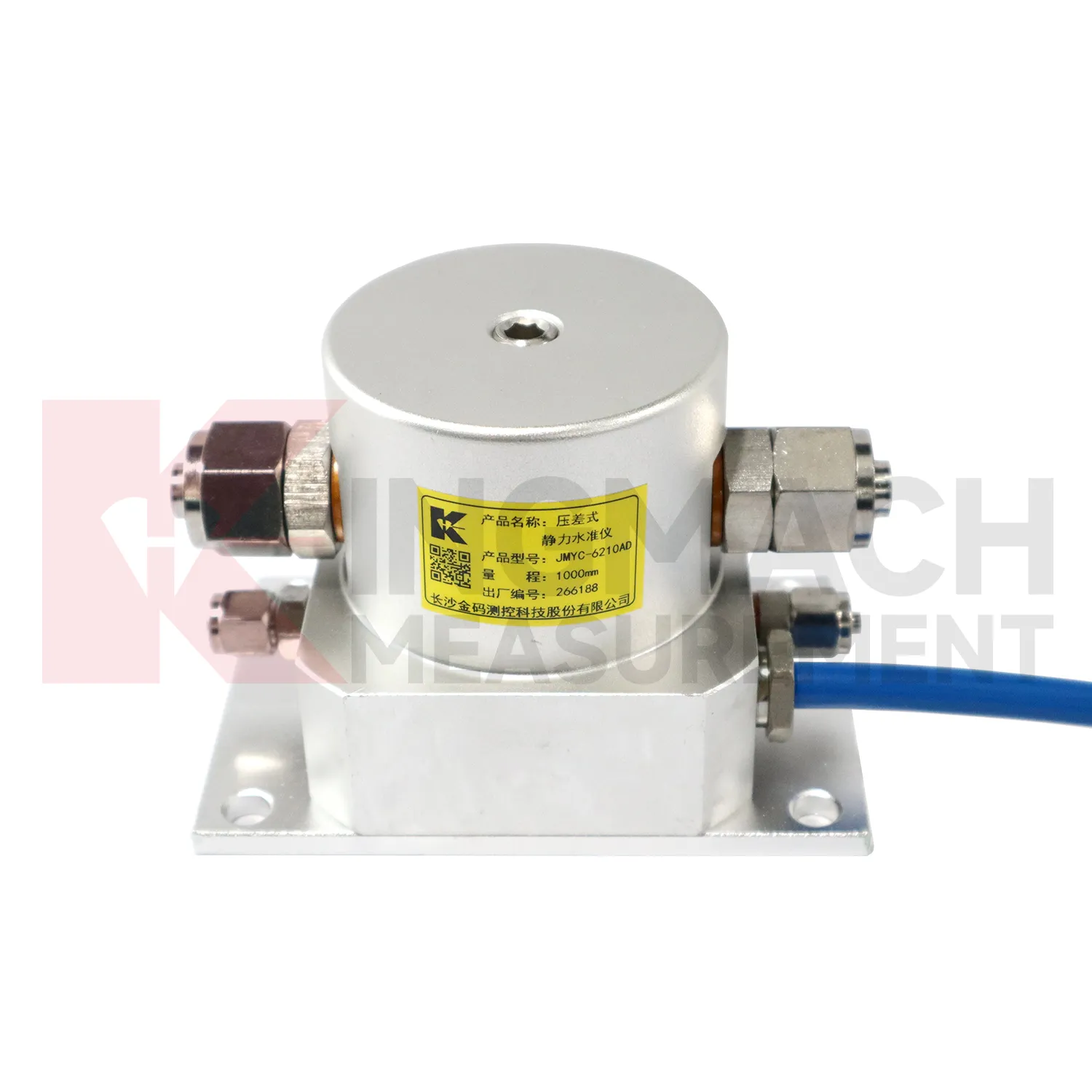
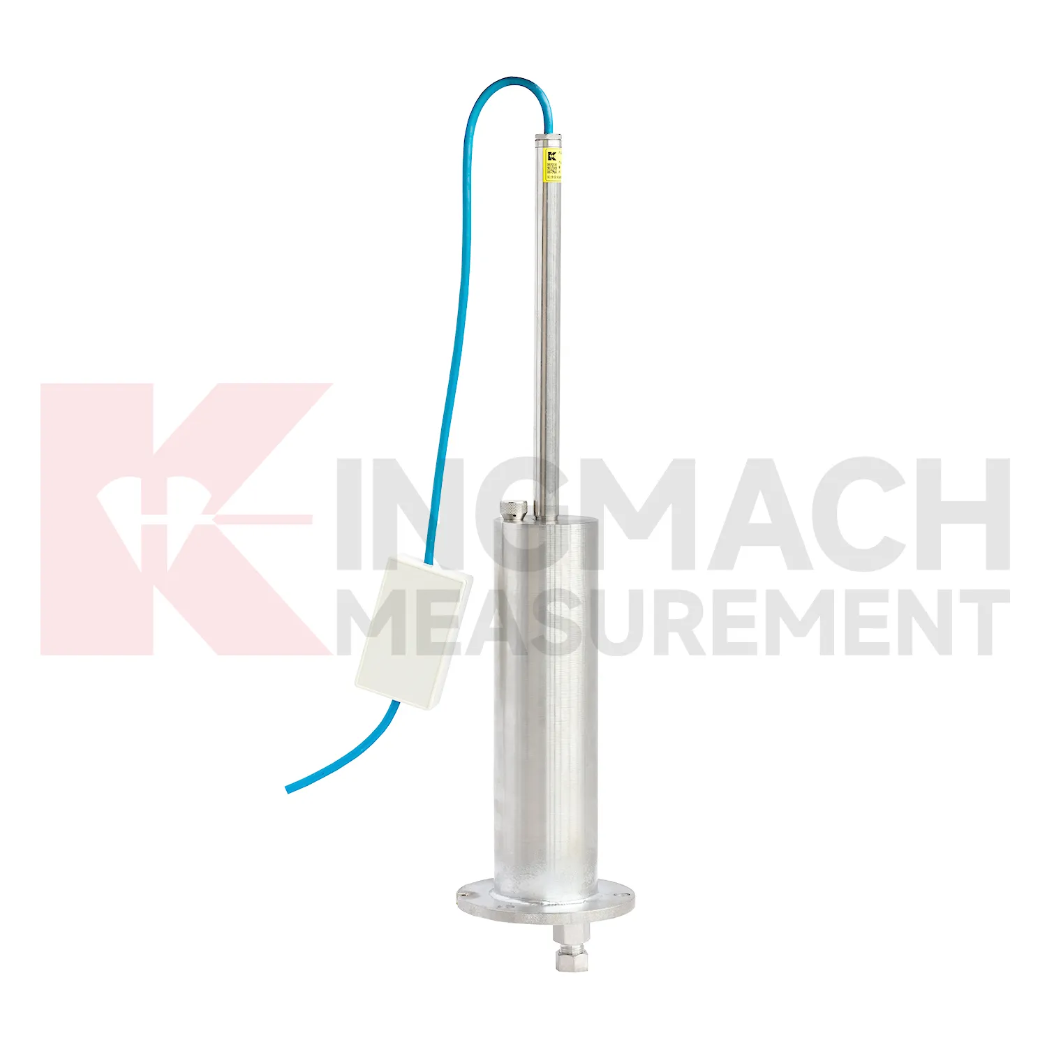
Tunnels and subway structures place special demands on gauge water level because access is narrow, moisture is common, vibration is continuous, and many instruments may share the same station or section. Kingmach JMDL-47XXAT is described for tunnel bottom uplift deformation and underground engineering settlement, making it suitable for embedded positions where the invert or base layer must be followed after construction. JMQJ-62XXADT can support hydrostatic level observation in tunnel settlement projects, with 50 mm and 100 mm ranges, 0.01 mm resolution, RS485 output, and IP68 protection. A tunnel layout should use point names that match chainage, ring number, track side, or station grid, otherwise later interpretation becomes slow and error-prone. Readings should be compared with excavation progress, lining closure, groundwater drawdown, rail bed work, train operation, and vibration records. The important question is whether vertical change is a short construction response, a reversible operating effect, or a continuing deformation trend. Good installation photos and baseline notes are especially useful because many embedded parts cannot be checked after the tunnel returns to service.
The future of gauge water level
The future of gauge water level will also depend on better installation kits. Many settlement errors begin with field details: a tube is kinked, a plate is disturbed during compaction, a ring depth is recorded poorly, a cable exits at the wrong place, or a reference point is not protected. Future products can reduce these problems with clearer connectors, pre-labeled cables, stronger side-exit protection, better probe markings, and commissioning checklists. Kingmach JMDL-47XXAT already uses side-exit cable routing to avoid pavement compaction interference, and hydrostatic systems rely on clean tube installation. Better installation accessories will make the first baseline more trustworthy. In settlement monitoring, a clean start is often more useful than a later attempt to correct a poor record. The practical goal is to keep settlement data understandable after the original installation crew has left, so owners can compare old and new readings without reconstructing the field history from memory. The same record should remain readable for designers, contractors, owners, and maintenance teams, because settlement monitoring often continues long after the first construction report is finished.
Care & Maintenance of gauge water level
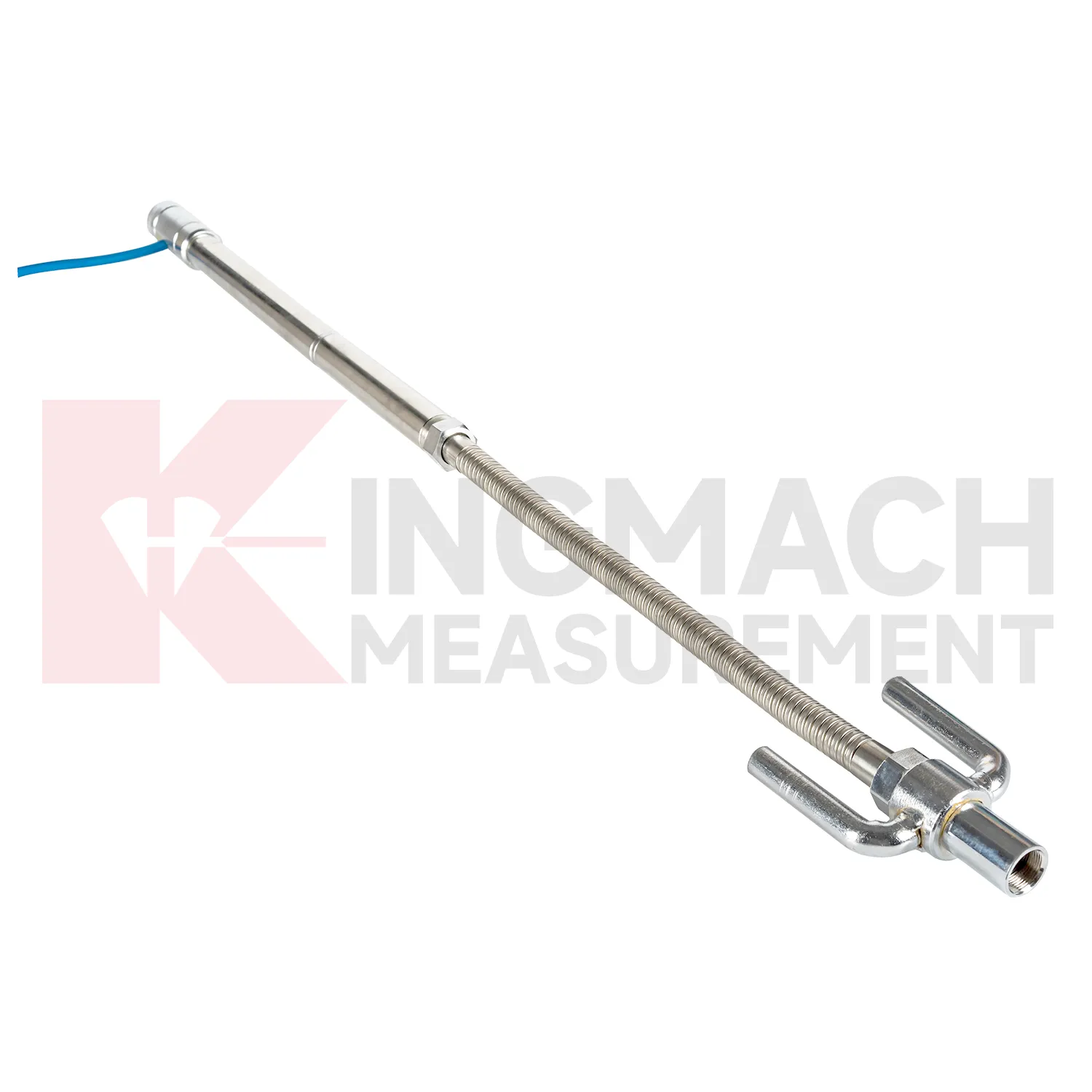
Embedded gauge water level such as JMDL-47XXAT require protection during earthwork, paving, and later traffic. The settlement plate, measuring rod, metal flexible conduit, anchor head, extension rod, bottom anchor, and side-exit cable should be installed without being bent or crushed by compaction equipment. Record installation depth, gauge length, cable exit point, fill layer, protection cover, and first stable reading before the point is buried. During maintenance, inspect accessible cable sections, junction boxes, cabinet terminals, and any area where later excavation may have disturbed the line. If a curve changes after a filling stage or pavement operation, compare the timing with construction logs before judging the ground response. Buried parts are difficult to inspect after coverage, so photographs, as-built sketches, and cable route notes become part of the working instrument. Good embedded-point care is mostly quiet prevention done before damage becomes visible.
Kingmach gauge water level
gauge water level are not only construction instruments; they also support long-term asset management. A bridge, dam, subway, railway, building, or embankment can continue moving slowly after the main construction phase is complete. Kingmach settlement products can help owners compare early baseline readings with later operation-stage data. The important question is whether movement has stopped, slowed, restarted, or changed after water level, traffic load, rainfall, excavation, or repair work. A clean settlement record should include cumulative value, daily or monthly rate, reference condition, sensor status, and inspection notes. When the same point is reviewed for years, small changes become easier to interpret. Without that record, later teams may waste time rediscovering what the original installers already knew. Over time, this disciplined record helps owners separate normal consolidation from renewed settlement caused by water, load, excavation, or long-term material behavior. Over time, this disciplined record helps owners separate normal consolidation from renewed settlement caused by water, load, excavation, or long-term material behavior.
FAQ
Q: What are gauge water level used for?
A: They measure vertical deformation such as foundation settlement, subgrade settlement, embankment heave, tunnel bottom uplift, dam settlement, bridge deflection, and building settlement.
Q: Which Kingmach models are related to this group?
A: Common models include JMDL-47XXAT, JMDL-62XXAT/ADT, JMQJ-62XXADT, JMYC-62XXAD, and JMCJ-1003/1005.
Q: What is the difference between single-point and hydrostatic monitoring?
A: Single-point gauges measure settlement at a specific embedded point, while hydrostatic systems compare several points against a reference level through connected liquid paths.
Q: Can the readings be collected remotely?
A: Yes. Several Kingmach hydrostatic and settlement instruments support RS485 output or automatic acquisition systems for remote collection.
Q: Why is the reference point important?
A: Settlement is often calculated relative to a reference. If the reference changes or is poorly documented, the whole settlement curve can become misleading.
Reviews
Joshua Clark
We ordered a full monitoring solution including sensors and data loggers. Everything works seamlessly together. Great supplier!
David Wilson
We purchased displacement transducers and settlement sensors, and the quality exceeded our expectations. Easy installation and reliable performance.
Latest Inquiries
To protect the privacy of our buyers, only public service email domains like Gmail, Yahoo, and MSN will be displayed. Additionally, only a limited portion of the inquiry content will be shown.
Evelyn***@gmail.comSouth Africa
Hi, we are a contractor working on tunnel construction and need settlement sensors and displacement ...
Mia***@gmail.comNetherlands
Dear team, we are interested in your readouts & data loggers compatible with multiple sensors. Do yo...
Related product categories
- Wide-Range Differential Pressure Hydrostatic Level Sensor
- Inductive Frequency-Modulated Hydrostatic Level Sensor
- water level gauge
- water gauge water level gauge
- water gauge level
- gauge water level
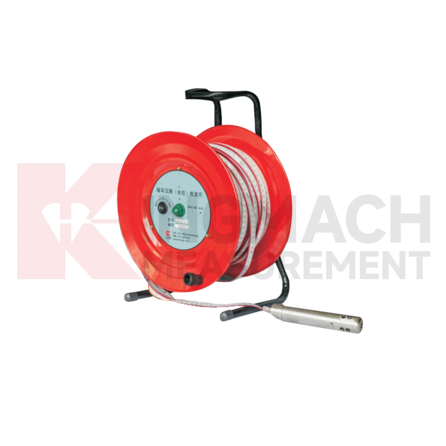
- Magnetic Ring Settlement Water Level Gauge
- Optical Deflection Monitor
- Tilt Sensor
- Deflectometer
- Micro Range Hydrostatic Level Sensor
- Single-point Settlement Meter