 ar
ar bg
bg hr
hr cs
cs da
da nl
nl fi
fi fr
fr de
de el
el hi
hi it
it ko
ko no
no pl
pl pt
pt ro
ro ru
ru es
es sv
sv tl
tl iw
iw id
id lv
lv lt
lt sr
sr sk
sk sl
sl uk
uk vi
vi et
et hu
hu th
th tr
tr fa
fa ms
ms hy
hy ka
ka ur
ur bn
bn mn
mn ta
ta kk
kk uz
uz ku
ku
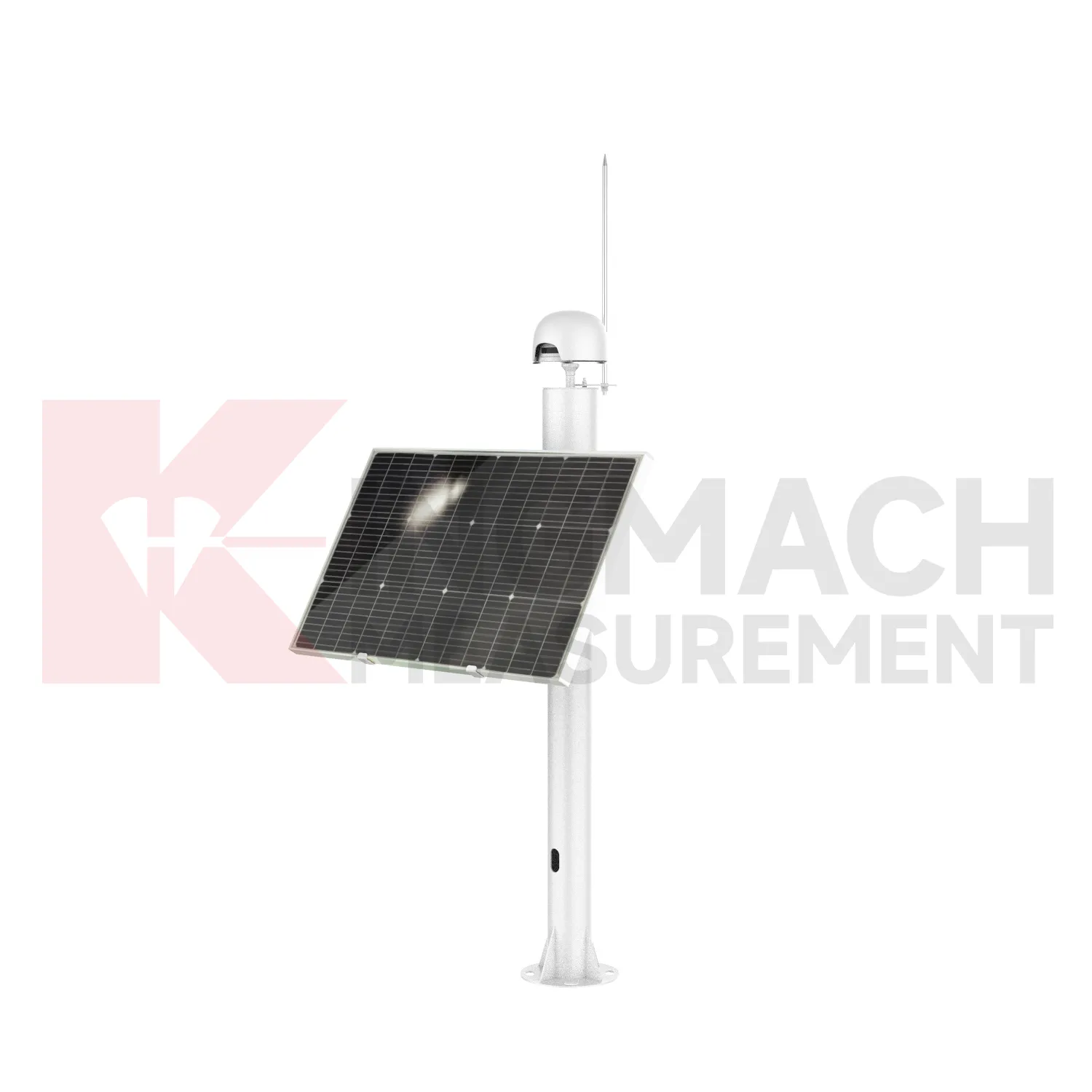
GPS Displacement Monitoring System
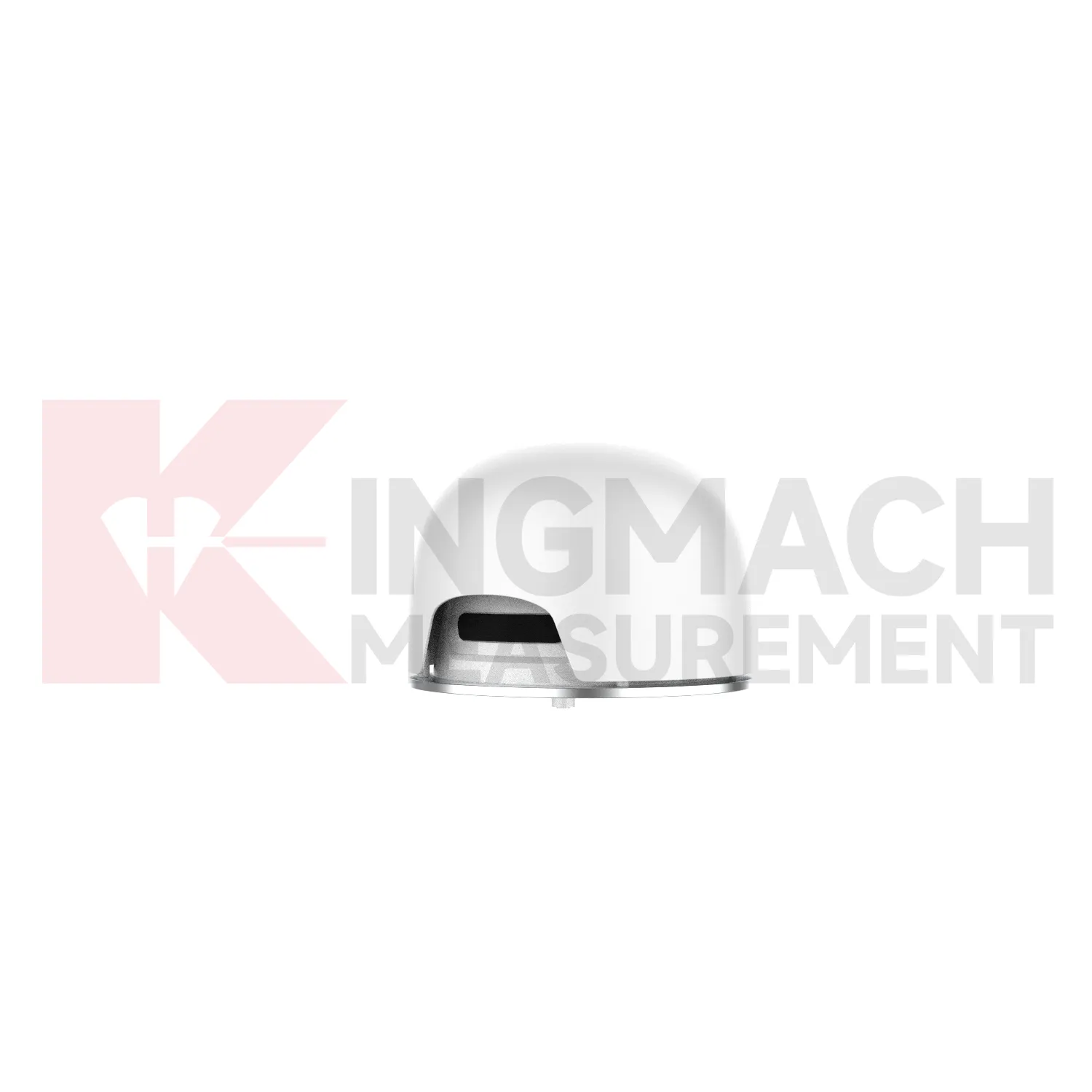
Kingmach GPS Displacement Monitoring System include the JMDL-49XXAT Smart Formwork Displacement Meter, also described as a steel wire displacement meter for high-formwork support, horizontal movement of formwork steel pipes, slope sliding, bridge abutments, tunnel portals, dams, and railway subgrades. Listed ranges include 50 mm, 100 mm, and 200 mm, with 0.01 mm sensitivity and 0.5%FS accuracy. The product uses patented inductive magnetic flux modulation technology, non-contact measurement, 20-point calibration curve correction, a built-in memory chip, and digital detection. It stores model, serial number, calibration coefficients, time, temperature, displacement values, and other records, with up to 600 stored data sets. The construction-grade details are important: product information lists IP68 protection, a 30-year service life, and a temperature range from -40 degrees Celsius to +100 degrees Celsius with plus or minus 0.5 degrees Celsius temperature accuracy. These features make it suitable for wet, dusty, and high-load construction environments. During project setup, the measuring point should be matched with the expected travel direction, available mounting space, cable route, and required acquisition interval. This prevents a short-range joint instrument from being used on a long-travel point, or an exposed sensor from being placed where an embedded anchor is needed. It also helps the monitoring team set a baseline that can be defended during acceptance and later maintenance review.
Application of GPS Displacement Monitoring System
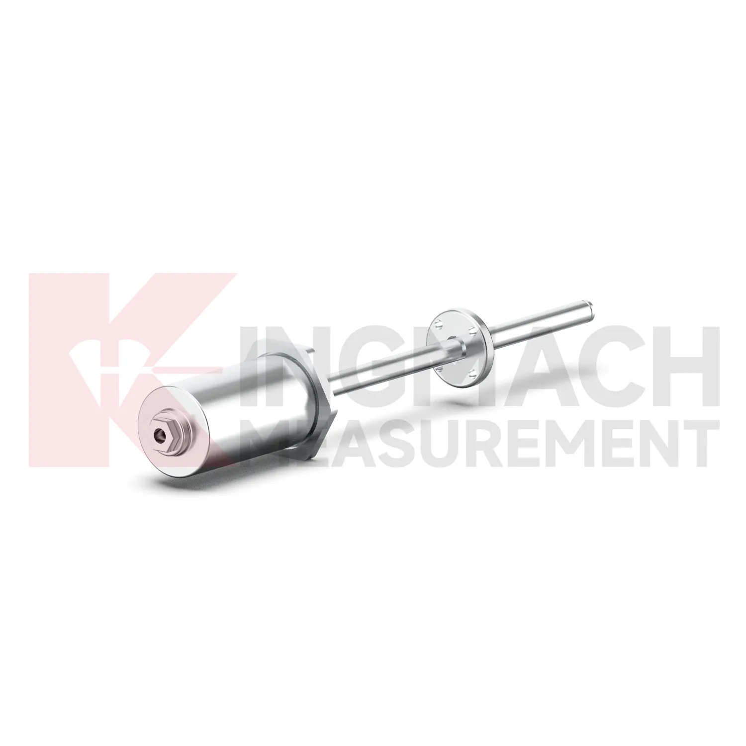
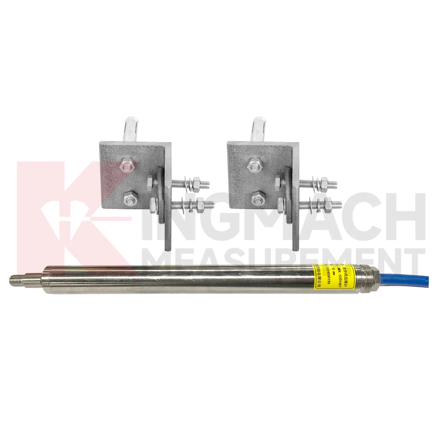
In foundation pit and deep excavation projects, GPS Displacement Monitoring System are used to watch retaining walls, soldier piles, soil nails, nearby pavements, basement walls, and adjacent structures as excavation stages remove support from the ground. The main site concern is not only how far one point moves, but whether movement grows after each excavation layer, support installation, dewatering step, or backfill stage. Kingmach JMDL-32XXAT single-point bedrock meters can measure embedded displacement at a selected reference layer, while JMDL-22XXAT crack gauges follow opening at nearby structures or retaining elements. JMDL-52XXADT differential meters provide high-resolution relative movement at joints or structural interfaces, and JMLS-22XXADT wire rope sensors can cover longer exposed paths where access is available. A useful pit monitoring plan records excavation depth, support timing, groundwater level, construction vibration, and surrounding building observations beside each displacement curve. This helps engineers distinguish bracket disturbance from real ground movement, and it supports faster decisions when a wall, road edge, or adjacent building begins to respond to excavation. During review, the same point should be compared with nearby settlement, tilt, support force, groundwater, and inspection notes so the movement is interpreted as part of the excavation behavior rather than as a single isolated value. during maintenance.
The future of GPS Displacement Monitoring System
Future GPS Displacement Monitoring System will need to serve both precision monitoring and construction-speed decisions. A long-term bridge joint may need high precision differential measurement over many years, while a high-formwork support may need fast warnings during a short concrete pouring window. Kingmach already separates these needs through product forms: JMDL-52XXADT for high precision relative displacement, JMDL-49XXAT for formwork and steel wire displacement, JMDL-24XXAT for flexible geogrid deformation, and JMLS-22XXADT for long travel draw-wire monitoring. As monitoring platforms mature, project teams can select sampling intervals, warning levels, and report formats by construction risk rather than using one schedule for every point. This will make displacement data more actionable for site managers, not only for later technical reports. The strongest systems will still depend on careful installation, because digital tools cannot correct a loose bracket, wrong range, or poorly recorded baseline. Clear reporting will make displacement monitoring more useful for non-specialist decision makers while preserving the detail engineers need.
Care & Maintenance of GPS Displacement Monitoring System
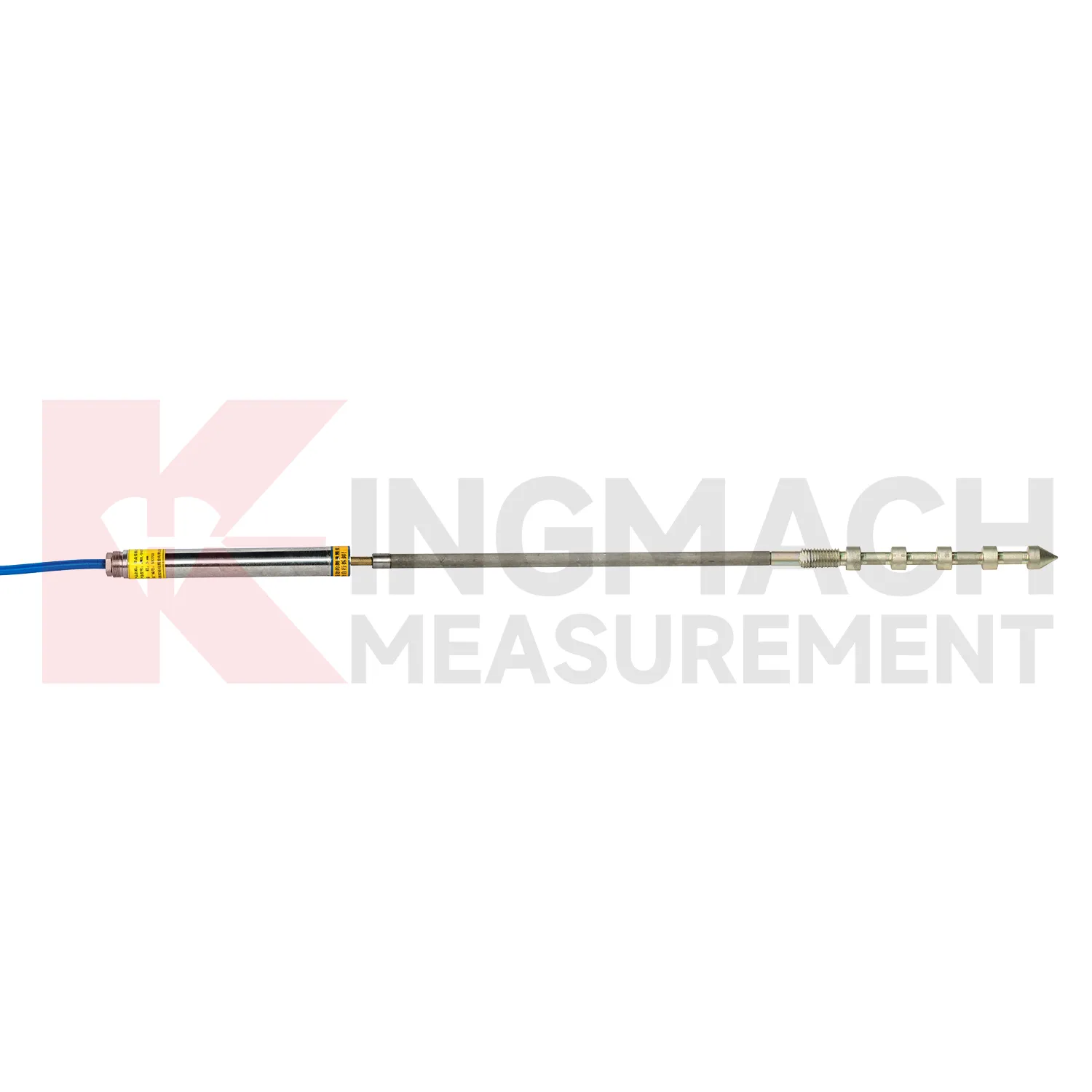
For GPS Displacement Monitoring System installed at cracks, joints, and expansion joints, maintenance should focus on bracket stability, rod alignment, cable protection, and baseline traceability. Kingmach JMDL-22XXAT crack gauges may use different measuring rods and universal bases, so the mounting points must remain firm while the structure moves naturally. Avoid placing rods where they can be hit by workers, tools, vehicles, concrete debris, or repair materials. During inspections, check whether the crack edge has spalled, whether the base has loosened, whether water has entered the connector, and whether the displayed movement agrees with nearby observations. Because the product can store up to 600 measurement results, compare field readings with stored records before resetting values. If temperature versions are used, keep temperature data with displacement data so seasonal opening and structural movement are not confused. Keep the installation photo, point number, zero value, and expected movement direction with the commissioning record for later review. If a reading changes after maintenance work, inspect the base, anchor, cable, and cabinet before assuming the structure itself has moved.
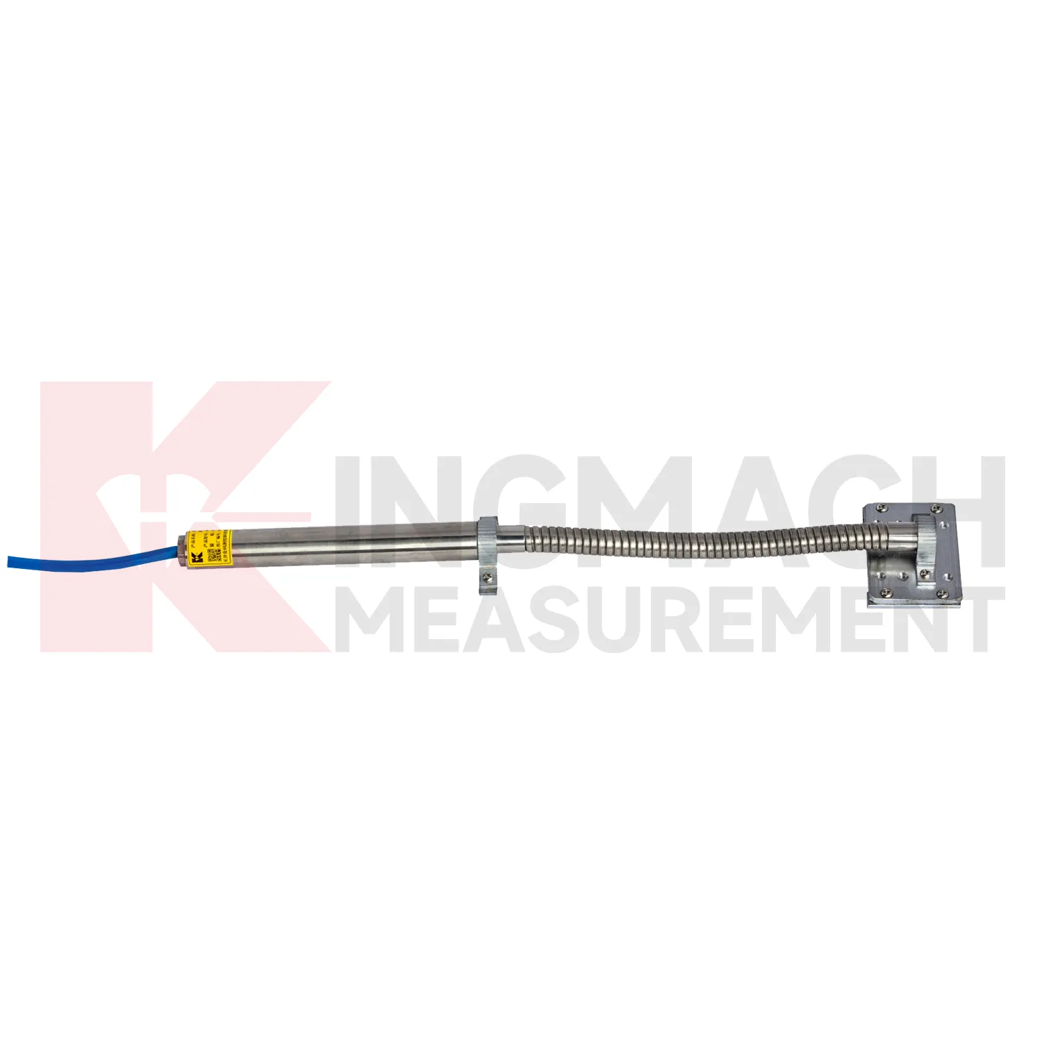
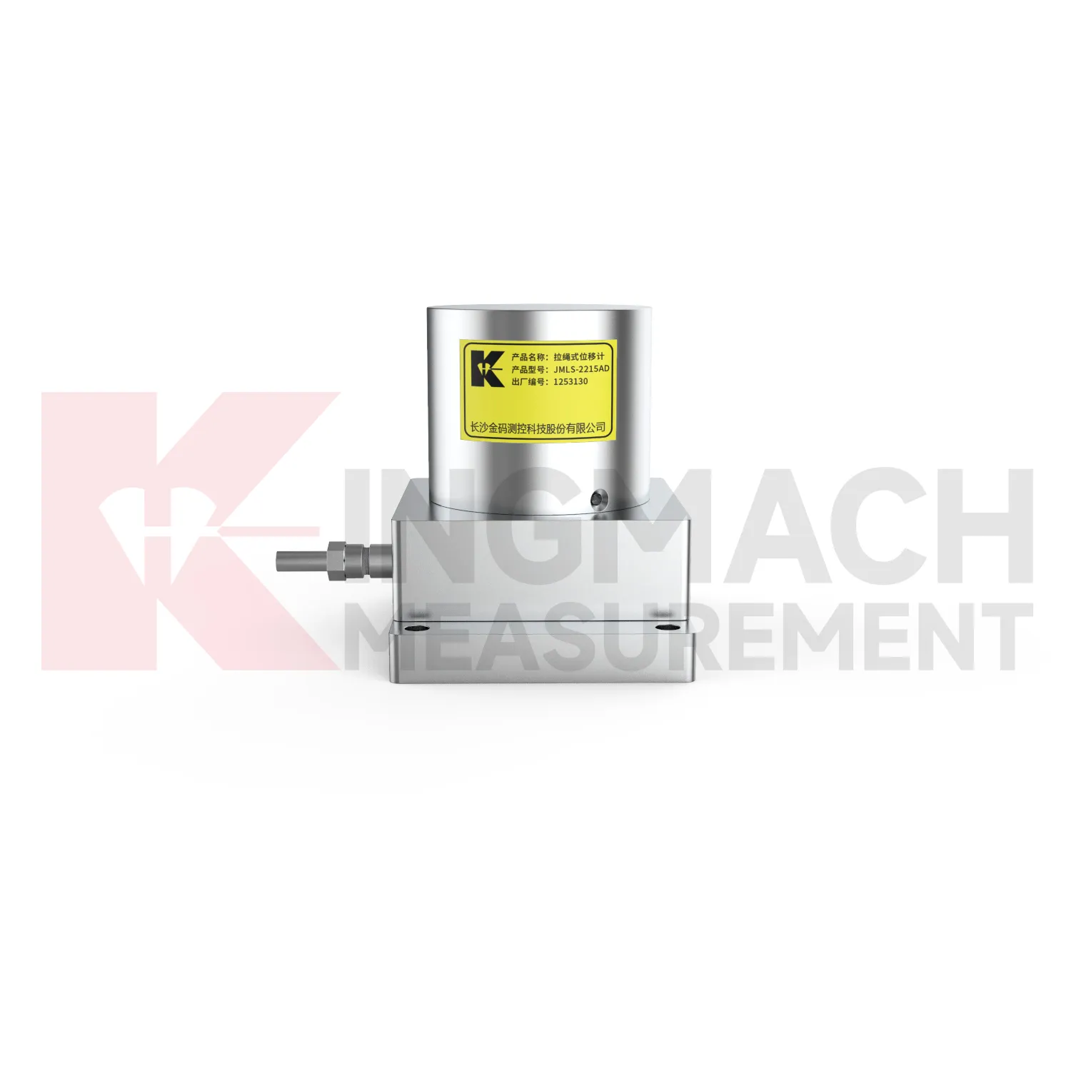
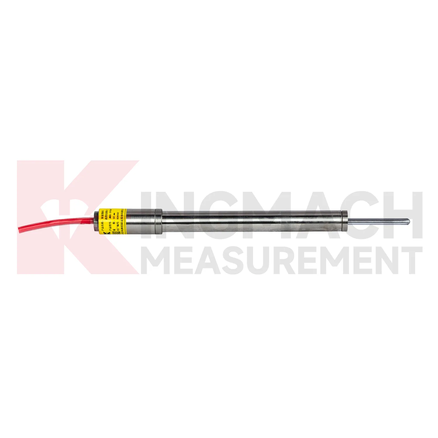
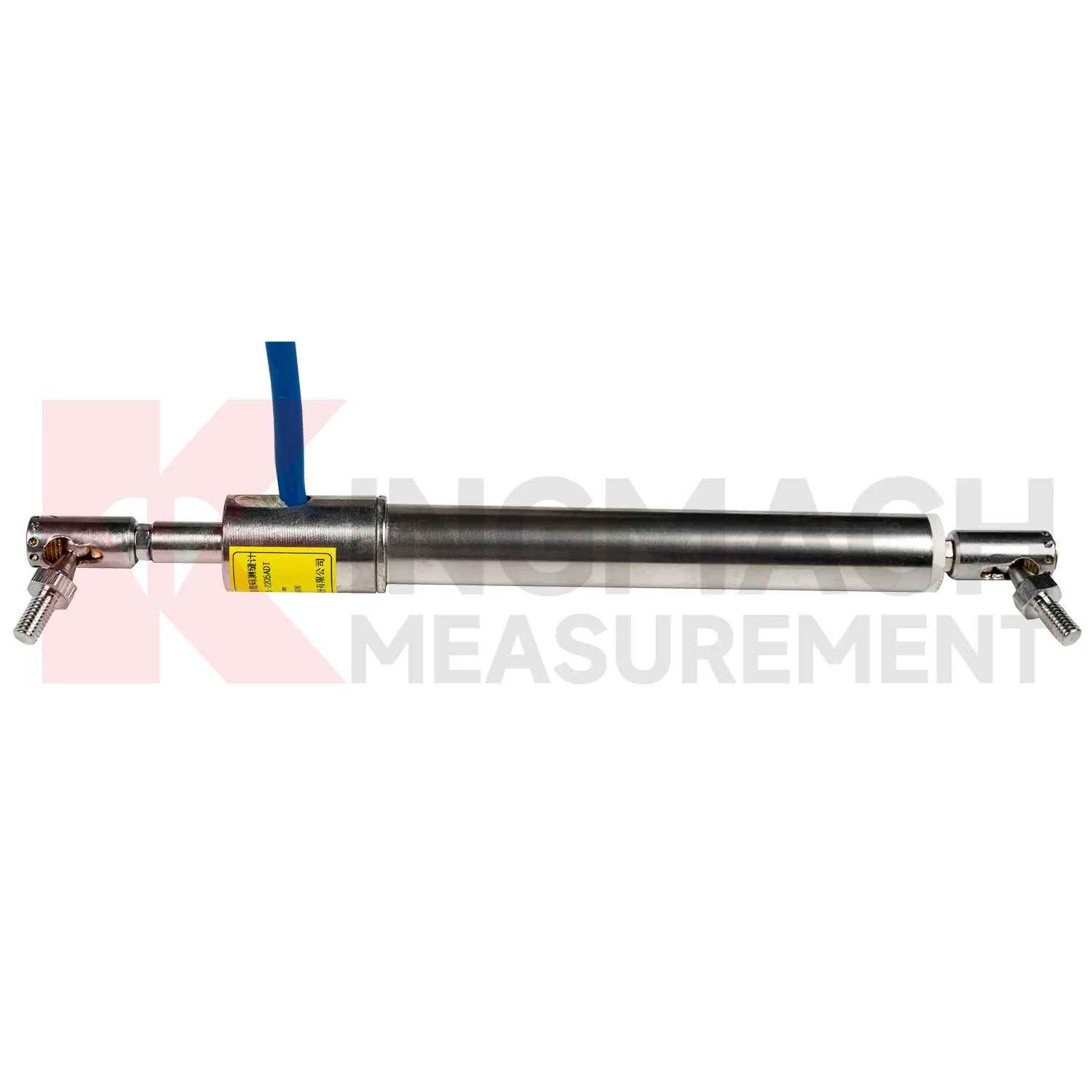
Kingmach GPS Displacement Monitoring System
For procurement teams, GPS Displacement Monitoring System should be matched to the way movement actually happens. Linear joint travel, crack width change, formwork settlement, rock layer slip, geogrid strain, hydraulic cylinder position, and long span cable pull are not the same measurement task. Kingmach's JMDL-52XXADT differential displacement meter lists 20 mm, 50 mm, and 100 mm ranges with 0.01 mm resolution, plus RS485 output and low temperature drift. The JMLS-22XXADT wire rope sensor reaches 500 mm, 1000 mm, and 2000 mm ranges with 0.1 mm resolution and IP67 sealing. The JMDL-49XXAT formwork meter is built for construction sites with IP68 protection and a 30-year designed service life. A good specification therefore starts with travel distance, mounting access, water exposure, signal distance, power supply, and whether the point must remain readable after construction equipment leaves the site. The point should be named on the drawing, linked with its cable route, and checked against the expected movement direction before the first automatic reading is accepted. For daily review, the reading should be compared with nearby points, recent weather, site operations, and any loading event that could explain the movement.
FAQ
Q: Which GPS Displacement Monitoring System fit crack monitoring?
A: The JMDL-22XXAT Smart Crack Gauge is designed for cracks, joints, and expansion joints in bridges, buildings, roads, railways, dams, tunnels, and slopes.
Q: What ranges does the crack gauge list?
A: Listed models include 20 mm, 50 mm, 100 mm, and 200 mm ranges, with 0.01 mm resolution on the 20 mm to 100 mm versions and 0.05 mm on the 200 mm version.
Q: How many records can the crack gauge store?
A: Product information states that it can save up to 600 measurement results, including time, temperature for temperature versions, displacement values, and zero-point value.
Q: What installation details matter most?
A: Base stability, rod alignment, connector sealing, cable protection, and a clear zero reading matter more than a polished-looking installation.
Q: Can it be used for long-term observation?
A: Yes. The product is described for long-term monitoring, especially where crack width changes need stable and repeatable measurement.
Reviews
Michael Anderson
The strain gauges and load cells are extremely accurate and stable. They performed very well in our bridge monitoring project. Highly recommended!
Christopher Martinez
Very satisfied with the readouts & data loggers. User-friendly interface and supports multiple sensor inputs.
Latest Inquiries
To protect the privacy of our buyers, only public service email domains like Gmail, Yahoo, and MSN will be displayed. Additionally, only a limited portion of the inquiry content will be shown.
Sophia***@gmail.comUnited Kingdom
Good day, we need environmental monitoring sensors including temperature, humidity, and wind sensors...
Olivia***@gmail.comUnited States
Hello, we are currently sourcing high-precision strain gauges and load cells for a bridge monitoring...