
 EN
EN
 ar
ar bg
bg hr
hr cs
cs da
da nl
nl fi
fi fr
fr de
de el
el hi
hi it
it ko
ko no
no pl
pl pt
pt ro
ro ru
ru es
es sv
sv tl
tl iw
iw id
id lv
lv lt
lt sr
sr sk
sk sl
sl uk
uk vi
vi et
et hu
hu th
th tr
tr fa
fa ms
ms hy
hy ka
ka ur
ur bn
bn mn
mn ta
ta kk
kk uz
uz ku
ku
Integrated Tiltmeter
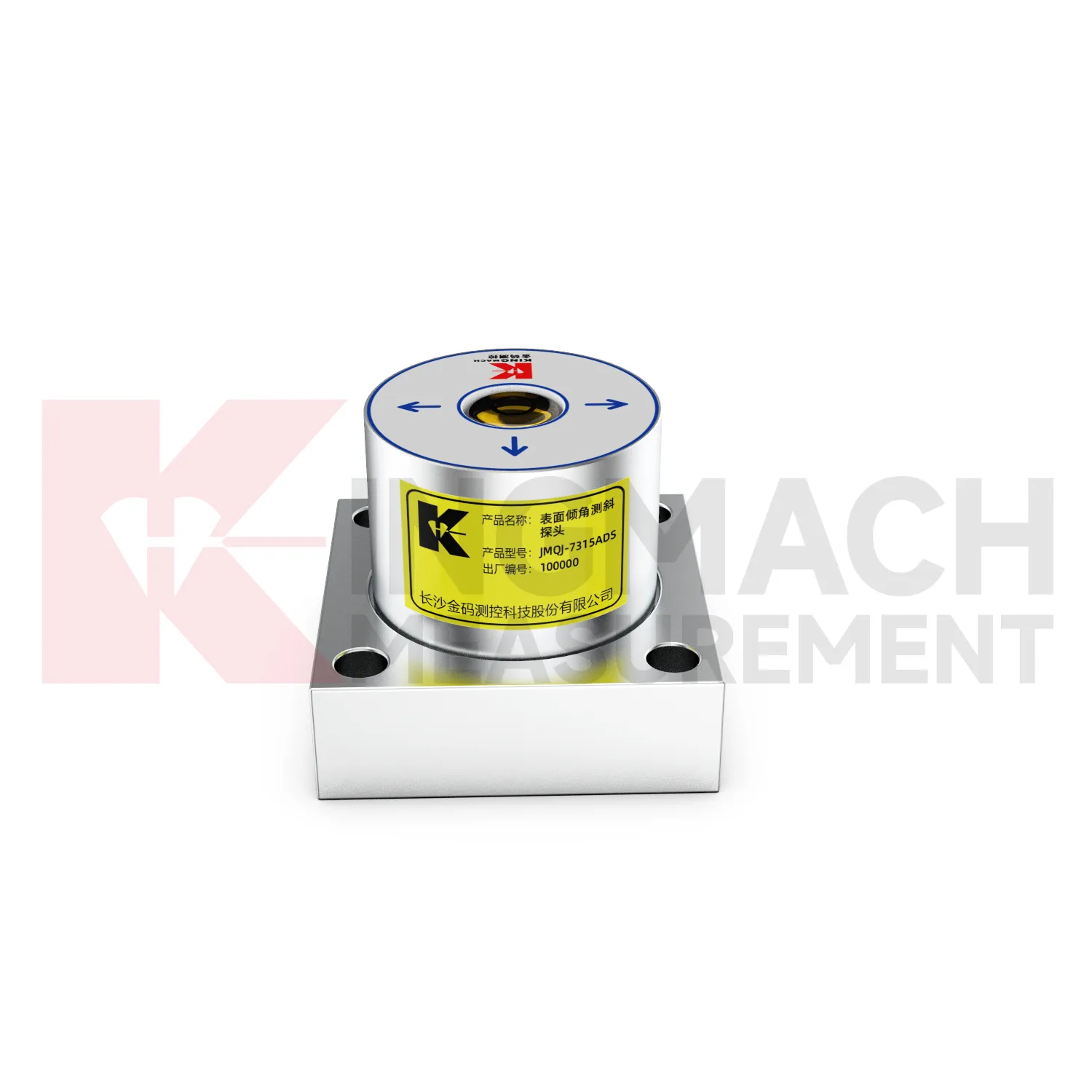
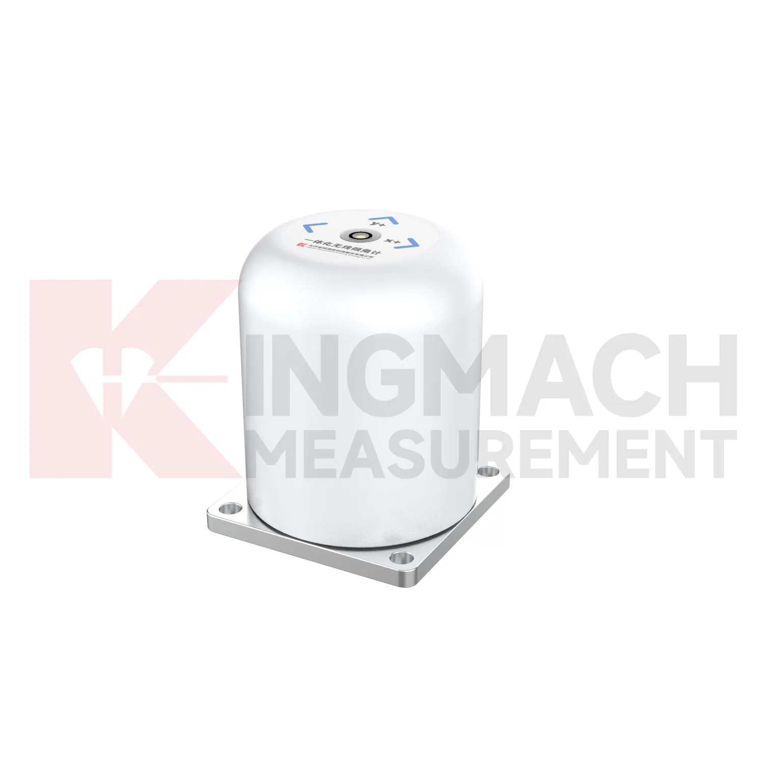
The JMQJ-7315ADS fixed tiltmeter is a key Kingmach Integrated Tiltmeter product for biaxial structural tilt monitoring. It uses MEMS technology, a high-precision acceleration integrated chip, differential measurement principles, 16-bit AD sampling, RS485 digital communication, a unique electronic code, and lightning protection design. The product is used to observe inclination angle change and deformation of bridges, buildings, railways, and other structures relative to the horizontal plane, including hidden parts that are difficult to observe by conventional methods. Published specifications include +/-15 degrees dual-axis measuring range, 0.001 degree resolution, 0.01 degree accuracy, DC 9V to 24V supply, power consumption below 0.5W, RS485 digital output, -30 degrees Celsius to +80 degrees Celsius operating environment, 55 mm by 55 mm by 46 mm dimensions, IP68 protection, and 0.6 kg weight.
Application of Integrated Tiltmeter
Foundation pit projects use Integrated Tiltmeter to monitor retaining wall rotation, support system response, adjacent building tilt, and deep ground movement during excavation. JMQJ-7315ADS can track angular change on exposed structures, while JMQJ-7915ATS can monitor multi-depth deformation inside a borehole. The excavation sequence, dewatering records, support installation dates, rainfall, and nearby settlement points should be reviewed beside the tilt data. If a retaining wall rotates while pore pressure or support force changes at the same time, the pattern deserves closer site checking. A practical layout marks the positive and negative axis direction before excavation begins, protects cables from machinery, and keeps baseline readings tied to excavation depth. This helps the monitoring team separate normal staged movement from a trend that may need immediate engineering review.
The future of Integrated Tiltmeter
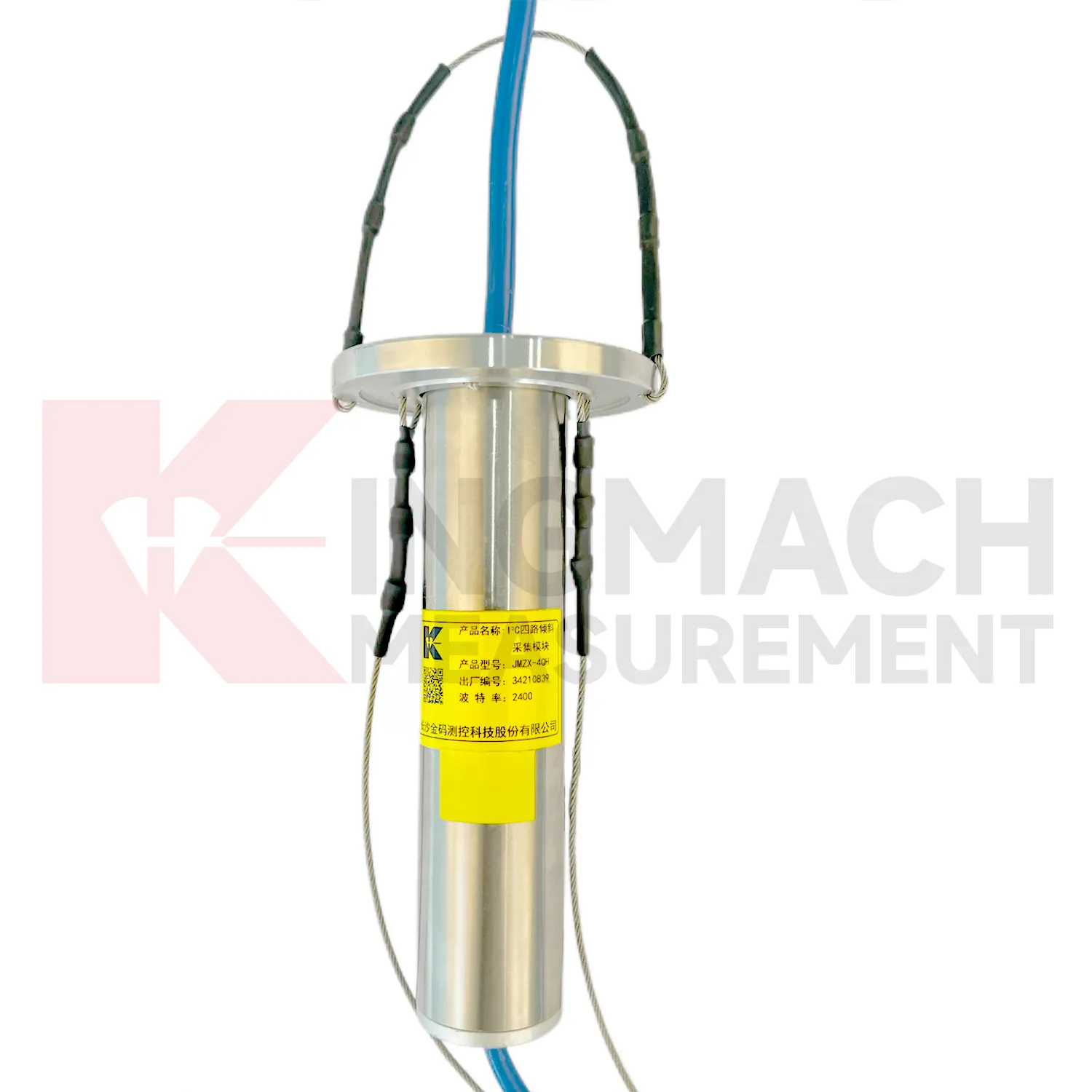
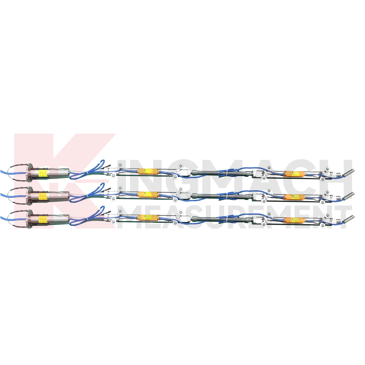
Multi-point borehole monitoring will continue to expand the role of Integrated Tiltmeter. JMQJ-7915ATS already connects multiple in-place inclinometer sensors through a single cable, with grouped communication, universal joints, connecting rods, electronic identifiers, and an orifice acquisition module. This type of system turns a borehole into a depth-based deformation profile rather than a single surface observation. Future improvements will likely focus on easier factory configuration, clearer point identification, lower power operation, and faster data review. Slopes, foundation pits, dams, embankments, and underground projects benefit from knowing where movement is happening inside the ground. Depth-specific tilt data can help teams move from general warnings to targeted inspection and reinforcement planning.
Care & Maintenance of Integrated Tiltmeter
Borehole systems for Integrated Tiltmeter need careful mechanical and data maintenance. JMQJ-7915ATS uses a multi-point tandem inclinometer string with universal joints, connecting rods, suspension, cables, and an orifice acquisition module. During installation, record measurement spacing, borehole ID, casing condition, orientation, group assignment, and factory configuration. During inspection, protect the orifice, check cable strain, review module status, and compare depth points for abnormal jumps. If one depth changes sharply while neighboring depths remain steady, inspect both the ground condition and the instrument chain. Borehole data is most useful when every depth point remains tied to a clear physical position and a stable orientation reference.
Kingmach Integrated Tiltmeter
A well planned Kingmach Integrated Tiltmeter installation starts with the engineering question, not with the sensor model. Is the project checking bridge pier rotation, building tilt, retaining wall movement, slope depth deformation, railway foundation behavior, or underground construction response? The answer determines whether a fixed biaxial tiltmeter, wireless integrated unit, sliding inclinometer, vertical in-place string, or acquisition module is required. It also determines where the reference direction should be marked, how often readings are taken, and what warning level means. Product parameters such as +/-15 degrees, +/-30 degrees, +/-90 degrees, 0.001 degree resolution, RS485, 4G, Bluetooth, IP68, IP67, and operating temperature should be linked to that project question. Clear planning keeps tilt monitoring useful throughout installation, commissioning, operation, and later review.
FAQ
Q: How often should Integrated Tiltmeter be inspected?
A: Inspection frequency depends on risk, access, construction stage, and deformation speed; active excavation or storm periods often need closer review.Q: What maintenance is needed for wireless tilt units?
A: Check battery status, antenna condition, upload timing, enclosure seals, point label, and platform channel naming.Q: What causes false tilt changes?
A: Loose mounting, disturbed cables, water entry, temperature effects, power faults, channel mistakes, or inconsistent manual reading can affect the record.Q: How should replacement be handled?
A: Record old and new model, serial number, range, baseline, reason, date, axis direction, channel name, and first stable value after replacement.Q: What makes tilt data useful over many years?
A: Consistent point naming, stable baselines, clear installation photos, protected hardware, visible maintenance records, and comparison with related site data.
Reviews
Robert Taylor
The weir flow meter is well-built and delivers accurate measurements. Great value for water management applications.
Michael Anderson
The strain gauges and load cells are extremely accurate and stable. They performed very well in our bridge monitoring project. Highly recommended!
Latest Inquiries
To protect the privacy of our buyers, only public service email domains like Gmail, Yahoo, and MSN will be displayed. Additionally, only a limited portion of the inquiry content will be shown.
Emma***@gmail.comCanada
Dear Sir/Madam, we are interested in displacement transducers and settlement sensors for a geotechni...
Evelyn***@gmail.comSouth Africa
Hi, we are a contractor working on tunnel construction and need settlement sensors and displacement ...